


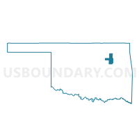
Voting District 705, Tulsa County, Oklahoma
About
Outline

Summary
| Unique Area Identifier | 655282 |
| Name | Voting District 705 |
| County | Tulsa County |
| State | Oklahoma |
| Area (square miles) | 13.57 |
| Land Area (square miles) | 13.57 |
| Water Area (square miles) | 0.00 |
| % of Land Area | 100.00 |
| % of Water Area | 0.00 |
| Latitude of the Internal Point | 35.90974290 |
| Longtitude of the Internal Point | -96.01374990 |
Maps


Graphs
Select a template below for downloading or customizing gragh for Voting District 705, Tulsa County, Oklahoma


Neighbors
Neighoring Voting District (by Name) Neighboring Voting District on the Map
- Voting District 29, Okmulgee County, OK
- Voting District 416, Creek County, OK
- Voting District 417, Creek County, OK
- Voting District 706, Tulsa County, OK
- Voting District 707, Tulsa County, OK
- Voting District 708, Tulsa County, OK
Top 10 Neighboring County Subdivision (by Population) Neighboring County Subdivision on the Map
- Sapulpa CCD, Creek County, OK (37,551)
- South Tulsa CCD, Tulsa County, OK (20,971)
- Beggs CCD, Okmulgee County, OK (7,200)
Top 10 Neighboring Place (by Population) Neighboring Place on the Map
- Sapulpa city, OK (20,544)
- Glenpool city, OK (10,808)
- Kiefer town, OK (1,685)
- Mounds town, OK (1,168)
- Liberty town, OK (220)
Top 10 Neighboring Unified School District (by Population) Neighboring Unified School District on the Map
- Glenpool Public Schools, OK (11,265)
- Beggs Public Schools, OK (5,479)
- Mounds Public Schools, OK (3,709)
- Liberty Public Schools, OK (3,163)
- Kiefer Public Schools, OK (2,694)
Top 10 Neighboring State Legislative District Lower Chamber (by Population) Neighboring State Legislative District Lower Chamber on the Map
- State House District 69, OK (43,787)
- State House District 80, OK (42,137)
- State House District 30, OK (37,080)
- State House District 24, OK (35,109)
Top 10 Neighboring State Legislative District Upper Chamber (by Population) Neighboring State Legislative District Upper Chamber on the Map
- State Senate District 37, OK (85,784)
- State Senate District 8, OK (75,663)
- State Senate District 12, OK (74,360)
Top 10 Neighboring 111th Congressional District (by Population) Neighboring 111th Congressional District on the Map
Top 10 Neighboring Census Tract (by Population) Neighboring Census Tract on the Map
- Census Tract 77.02, Tulsa County, OK (7,852)
- Census Tract 6, Okmulgee County, OK (7,200)
- Census Tract 215, Creek County, OK (5,379)
- Census Tract 77.01, Tulsa County, OK (5,106)